
Richfield ZIP Code Coverage
Official Hennepin material reviewed for Richfield verifies one postal designation: 55423. That is the only ZIP supported by the project research for city addresses. The research did not verify an added institution, adjacent-city, or post-office ZIP for Richfield, so none is listed here. The city’s maps and its roughly seven-square-mile boundary provide a municipal reference, while postal service determines the address-level designation.
| ZIP Code | Areas covered in reviewed material | Post office or station | Record note |
|---|---|---|---|
| 55423 | Richfield, as paired in official Hennepin needs-assessment material | Not located in the official sources reviewed | Primary verified designation; confirm each full address with USPS. |
The Richfield ZIP code directory should stay this narrow until an official postal or city source confirms another city-address designation. A city mailing label, a precinct, and a parcel field do not establish the same geography.
Verified 55423 in Richfield
Use 55423 as a starting label, then verify the specific street address. The official USPS ZIP Lookup is the address-level authority. Its endpoint returned an internal error during the research pass, so no sample result is reproduced here. That gap matters: a ZIP attached to a general city reference is not a substitute for a full-address result.
Compare the postal return with the City of Richfield address mapbook, which is organized as a cover, pages 3 through 18, and page A. The city also provides engineering maps for roads, sidewalks, addresses, as-builts, and benchmarks. When a result will be used to follow a property record, retain the full street address and the parcel identifier alongside the postal result.
Richfield ZIP Parcel Fields
Hennepin’s parcel-data service is ZIP-capable because its published schema includes `ZIPCODE`, `FORMATTED_ADDRESS`, city, street components, and parcel identifiers. It also lists land-use, zoning, community, ward, owner or taxpayer field names, assessment and tax years, values, homestead status, and structure fields. Those published fields help compare an address across map and assessment data, but they are not an assurance that every attribute is displayed in the consumer property search.
The property search itself accepts an address, 13-digit PID, addition name, or interactive map. The research did not find an explicit ZIP-only or whole-ZIP filter on that consumer page. Use the ZIP as an attribute to compare after the parcel is found, not as a claim that the county portal provides a complete citywide postal-area roster.
The official Hennepin parcel-data service documents the ZIP and formatted-address fields used for this comparison.
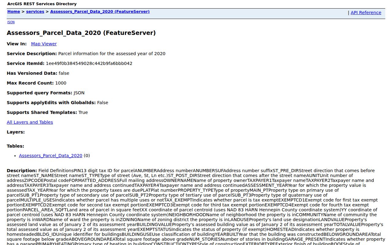
Keep the PID and legal description with the ZIP field when an address has multiple units, a parcel split, or an older street form.
Note: The parcel service labels a ZIPCODE field, but the research did not verify a consumer portal filter that returns every Richfield parcel in that ZIP.
Find Residents in a Richfield ZIP
A ZIP narrows the geography but does not create a list of people. Start with an address that is already known, verify its postal result, and then inspect the matching parcel. The parcel record can provide a PID and legal description for property research. Election tools serve a different purpose: MyBallot gives civic geography, while MNVotes confirms one known registration after the required match fields are supplied.
- Enter the full address in USPS ZIP Lookup and save the returned postal city and ZIP.
- Check the address against Richfield maps, then search Hennepin property information by exact address or PID.
- Inspect the parcel service’s `ZIPCODE` and formatted-address fields through an official interface or data request if a geographic grouping is needed.
- Use MyBallot for election, precinct, and district context. Use MNVotes only for a known person’s registration match.
- When the postal area has narrowed to a particular street, continue with the Richfield street directory for the address-keyed parcel and deed trail.
For a whole-area parcel inventory, request or filter Hennepin GIS data through an official interface or request channel. RecordEASE expressly prohibits bulk parcel-data downloads and screen scraping, so use targeted property-history searches instead.
Richfield MyBallot ZIP Results
Minnesota MyBallot accepts an address or a ZIP search switch and returns the next election, polling location, ballot, precinct and district information, plus caucus-location information. It supplies civic geography, not the names of every registered voter in a postal area. Its result is useful when a street’s mailing label, city boundary, and election district need to be kept separate.
| MyBallot field | Input | Purpose |
|---|---|---|
| Address | Address input | Find election and polling-place information for that location. |
| ZIP Code search | Search switch | Begin a civic-geography search by postal designation. |
| Search | Action control | Returns election, polling location, ballot, precinct, districts, and caucus information. |
The MyBallot ZIP search screen is the official civic tool illustrated here, but it does not function as a resident directory.
Use its district return beside the address and parcel keys, rather than treating a civic search as a personal record result.
Note: Keep a MyBallot result separate from parcel and voter-registration records, because each uses ZIP geography for a different purpose.
Richfield ZIP Registration Match
Minnesota My Voter Registration offers a ZIP or county route within an individual registration match. It requires first name, last name, birthday, city or township, house number, and street, with a unit number required when the unit box is selected. The lookup says its information is updated nightly, while election officials may take up to 14 days to process a registration. A missed match can result from spelling, a recent application, an address change, or protected data.
The returned experience is a confirmation or instruction path, not a ZIP-wide resident list. Minnesota law permits inspection and copying of specified public voter information after a complete request with identification and a written use statement, subject to the statutory restrictions and reproduction costs. Full birth date and identification numbers are withheld, and voting history does not disclose ballot choices. Keep an individual registration result separate from a postal or parcel result.
Under Minn. Stat. §201.091, the public information list can include name, residence address, year of birth, voting history, optional phone number, and districts. The election official must provide a statewide list or a list of Minnesota voters within five business days after a complete request, subject to the law’s requester requirements and reproduction cost. That access route is separate from a search by ZIP and cannot be republished as an online searchable database.
Richfield ZIP Boundaries and City Limits
Postal delivery areas are not municipal boundaries. The source material specifically warns that a postal-city result, city-limit label, voter precinct, and tax situs may not agree. Fort Snelling residents appear in Richfield Precinct 7 polling information, but that civic fact does not establish that Fort Snelling is within Richfield’s city limits or uses 55423. Keep every label with the authority that supplied it.
- ZIP and ZIP+4
- A ZIP is a postal-area code. ZIP+4 adds a more specific delivery segment to the basic ZIP.
- PO box ZIP
- A designation for post-office-box delivery rather than a general street-delivery area.
- Unique ZIP
- A code assigned to one organization or delivery destination. None was verified for Richfield in the reviewed sources.
- Carrier route
- A postal delivery grouping that is not a municipal boundary or a parcel identifier.
PID and legal description provide stronger parcel continuity than a mailing label. A legal description identifies the recorded land, and the 13-digit PID is the practical link from a street address to that description in Hennepin systems.
Historic Richfield ZIP Searches
Older city directories did not use today’s postal codes as their organizing key. Search the printed city and street form, then test the historic spelling, direction, street type, and number style. Hennepin Library’s digitized directory guidance supports exact-text searching with `*` and `?` wildcards, except at the first character, and lets researchers deselect unwanted cities. Telephone directories and Sanborn maps can fill context around a historical address.
Do not infer a historic ZIP from a modern address result. Instead, preserve the directory page, year, and printed address, then compare it with the lot, block, addition, parcel geometry, or deed legal description. This keeps a current postal label from obscuring an older Richfield or Minneapolis record label.
Note: Historic address work relies on the printed street form and parcel continuity, not on a modern postal designation.
Richfield ZIP Boundary History
Richfield’s original footprint was larger than the present city, and territory was annexed to Minneapolis in 1927. The circa-1940 Richfield atlas has 23 pages, but maps 1 through 11 for the annexed territory are missing; maps 12 through 32 survive. A historic image or directory marked Minneapolis may therefore reflect the boundary era rather than a wrong address.
The research did not locate an official ZIP split, realignment year, or post-office station assignment for Richfield. That uncertainty is a reason to use USPS for the full address and city maps for the municipal question, not to fill a gap with an assumed postal history.
Richfield ZIP Directory Limits
A ZIP code directory can organize postal and civic checks, but it cannot establish present presence at every address. The MNVotes registration lookup requires first name, last name, birth date, ZIP or county, city or township, house number, and street. It provides a registration-status confirmation or instructions. It is not a downloadable list, and the research did not capture a live positive or negative result screen.
Minnesota’s public voter-list law distinguishes public information from protected data and bars online searchable republication. Safe at Home participants use protected actual addresses. Use address and parcel records for their stated roles, keep protected information out of notes, and do not infer a complete resident list from a postal or civic result. The Richfield ZIP code directory is strongest as a verification path, not a roster.